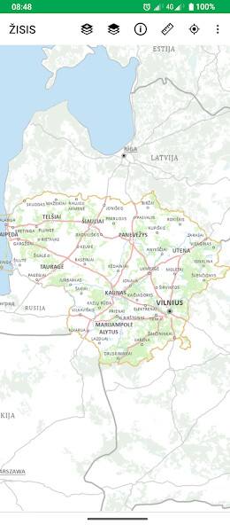
We provide ŽISIS online (apkid: lt.vzf.zisapp) in order to run this application in our online Android emulator.
Description:

Run this app named ŽISIS using MyAndroid.
You can do it using our Android online emulator.
From 01.01.2024, the new name of the Earth Information System (IS) is the Earth Resources Monitoring Information System (ISIS).
The task of ISIS is to use information technologies to create spatial data sets (hereinafter - Spatial data sets about land) and maps, which would collect and display information about areas of abandoned land, areas of drained land, the condition of drained land areas, the layout of soils, their physical and agrochemical properties and other characteristics affecting land use.
The purpose of ISIS is to systematically monitor, analyze and forecast the state of the country's land resource use, identify changes due to anthropogenic impact, justify rational land use and environmental improvement measures, and provide statistical information to users.
Using the ISIS app, users can view and use ISIS and other spatial data sets on their mobile device.
If you have comments, suggestions, please contact us by e-mail.
by mail zisis@zudc.lt
ISIS data consists of state thematic spatial data sets and other thematic spatial data sets, which collect information on characteristics affecting land use.
State thematic spatial data sets:
- M 1: 10000 soil spatial data set of the territory of the Republic of Lithuania (Dirv_DR10LT);
- M 1: 10000 dataset of agrochemical soil properties of the territory of the Republic of Lithuania (DirvAgroch_DR10LT);
- M 1: 10000 set of land reclamation condition and waterlogging spatial data of the territory of the Republic of Lithuania (Mel_DR10LT);
- Spatial data set of abandoned lands of the territory of the Republic of Lithuania (A_DRLT).
Copyright of spatial data sets and maps: https: //zisis.lt/programeles/autoriu-teises/
More information about ISIS: https: /zisis.lt/
MyAndroid is not a downloader online for ŽISIS. It only allows to test online ŽISIS with apkid lt.vzf.zisapp. MyAndroid provides the official Google Play Store to run ŽISIS online.
©2025. MyAndroid. All Rights Reserved.
By OffiDocs Group OU – Registry code: 1609791 -VAT number: EE102345621.